
The documentation was cleared during January 2013 by the SOTA management team after some amendments and updates. VK1 was then given a start date of 1st February.
To make the day memorable we encouraged VK1 activations via email lists and a presentation at the local club a week earlier. We asked chasers to tune in and help us get our required contacts. Activations at 0000 UTC were by Andrew VK1NAM at Booroomba Rocks, Matt VK1MA at Mt Stromlo, Russell VK1JRM at Tuggeranong Hill and by me at Mt Taylor. I logged 20 contacts on a combination of 7 MHz SSB and 146.5 MHz FM. Later in the day Ian VK1DI walked up Mt Majura and activated successfully with VK3 and VK5 contacts.
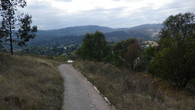
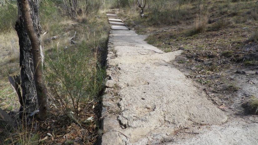
There are a few possible approaches to climbing Mt Taylor. The route I chose was from Sulwood Drive, Kambah. This route may be a little longer than the Pearce or Chifley approaches. Parking on Sulwood drive near the intersection with Manheim St, the walking path is easy to find and leads up a steady rocky path, which eventually becomes a bitumen sealed path, gives way to compressed gravel, some concrete in places and some wooden framed steps in other parts of the trip.
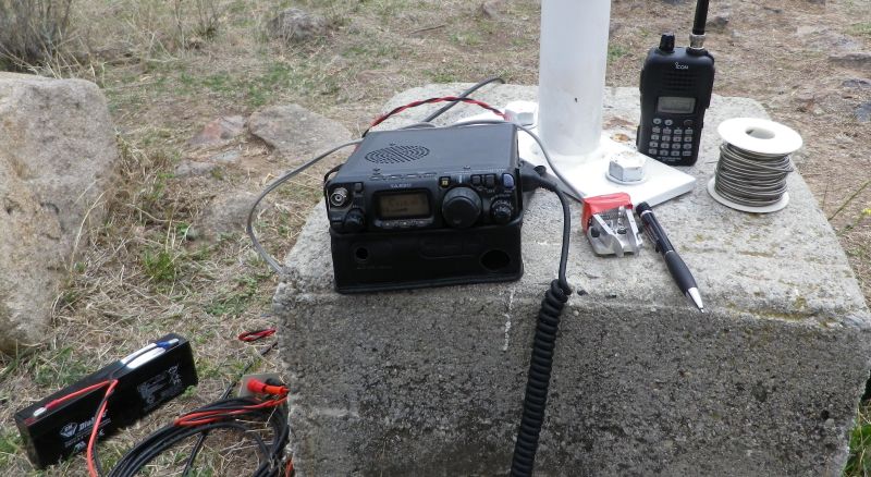
On arrival at the summit, the squid pole was extended and the central feedpoint of the 40m dipole was attached to it using cord. The ends of the dipole insulated by several metres of cord are attached to tent pegs hammered into the ground. A stone could be used as a hammer but I took a rubber mallet for this purpose.
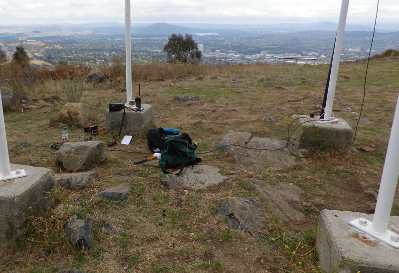
The FT817 was powered by a 2.1 AH SLA Battery. Note the miniature morse paddle, purchased as a kit at Dayton Hamvention in 2010. This paddle is nice but too light so it needs to be held with one hand while you send with the other. Attaching it to a lump of heavy metal (not a Metallica album) would solve the problem but also add to the weight in the backpack (see below).
Signals on 40m were very good. Easy contacts were made around VK1 and with VK3 stations, including some SOTA activators on summits in VK3.
After liaising with Bruce VK1HBB on 2m we also made contact on 7090 where we had our first SOTA contact for VK1. After that the fun began and at times three frequencies were in use on 40m, while on 146.5 FM the Icom radio chattered away with a continuous series of contacts between VK1HBB, VK1FPIT and VK1FTAY who were portable at Mt Ainslie, VK1NAM at Booroomba Rocks, VK1MA at Mt Stromlo, VK1JRM at Mt Tuggeranong, VK1DR, VK1SV and VK1DI.
On HF I did call cq on CW at one stage but activity on CW during week days is rather low. This must be why my signal was discovered by an automatic skimmer run by Lyle VK1LW, whose station logged my CQ call and that ended up on SOTAWATCH as a spot.
Everyone involved seems to have enjoyed the day. A field day with a difference. Several operators took leave from work to activate on this day and we appreciated also the efforts of VK3 and VK5 activators and chasers who turned up on time to give us contacts and get these new SOTA summits into their chaser logs. No doubt from this point on we will gain new activators and chasers as familiarity with the award increases.
I would like to use more bands for these events. Some activators are routinely making CW contacts into Europe and the USA, some are making some ssb contacts, using 20m and 15m bands.
I underestimated the amount of equipment I would be trying to stuff into my ordinary backpack, and how much it weighed when I did! And that was a single band wire antenna, and a 2m handheld with its own flexible antenna. Carrying a real 2m antenna would add more complexity and weight. The SOTABEAMS enterprise in the UK offers readily assembled beams for various bands. For HF, some operators like horizontal antennas, both centre fed and end fed. Some like verticals. Your mileage does vary depending on what you are trying to do. The verticals would surely be better for DX contacts.
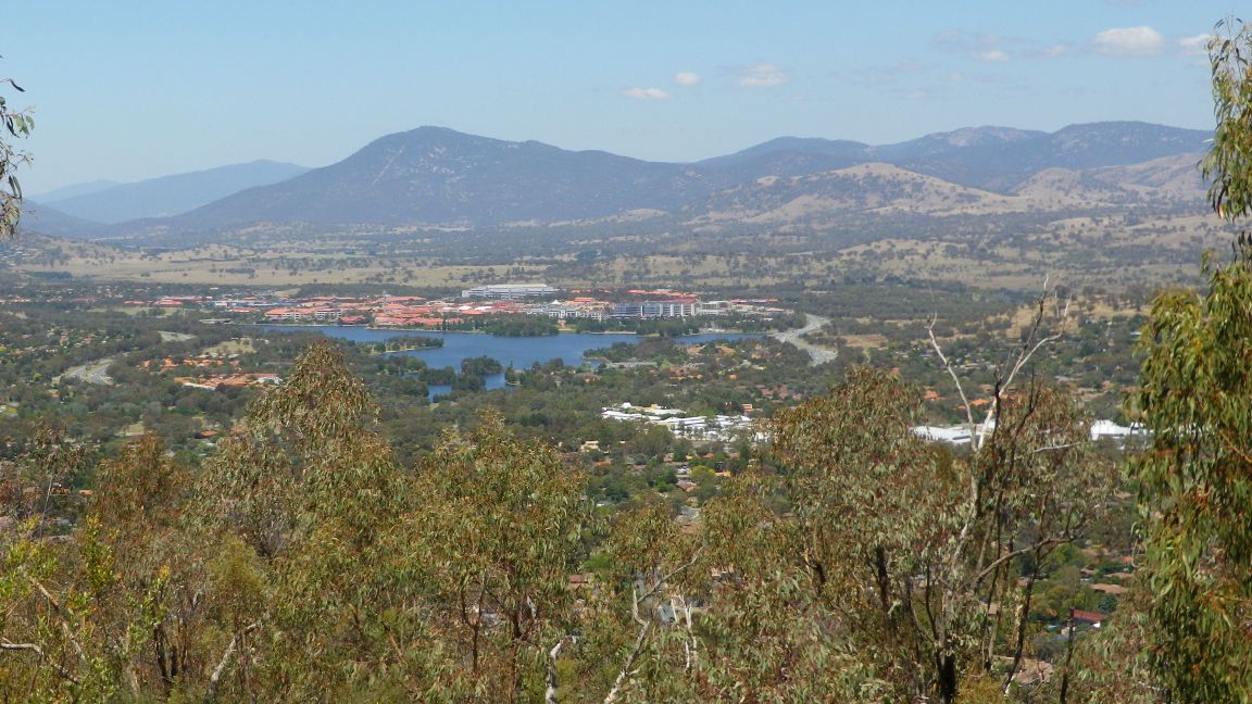
Scenery
On the way down Mt Taylor I noticed a panoramic map installed by our friendly local government, showing the features of the Tuggeranong Valley and naming the mountains in the distance and on the horizon. Some of these will be familiar to readers, and some will be more familiar in a year’s time as many of the names seen here are SOTA summits.
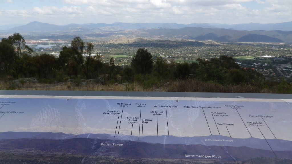

The prominent mountain behind the town centre is Mt Tennent, named after a bushranger. The fable is that he buried treasure of some kind up there before being captured.
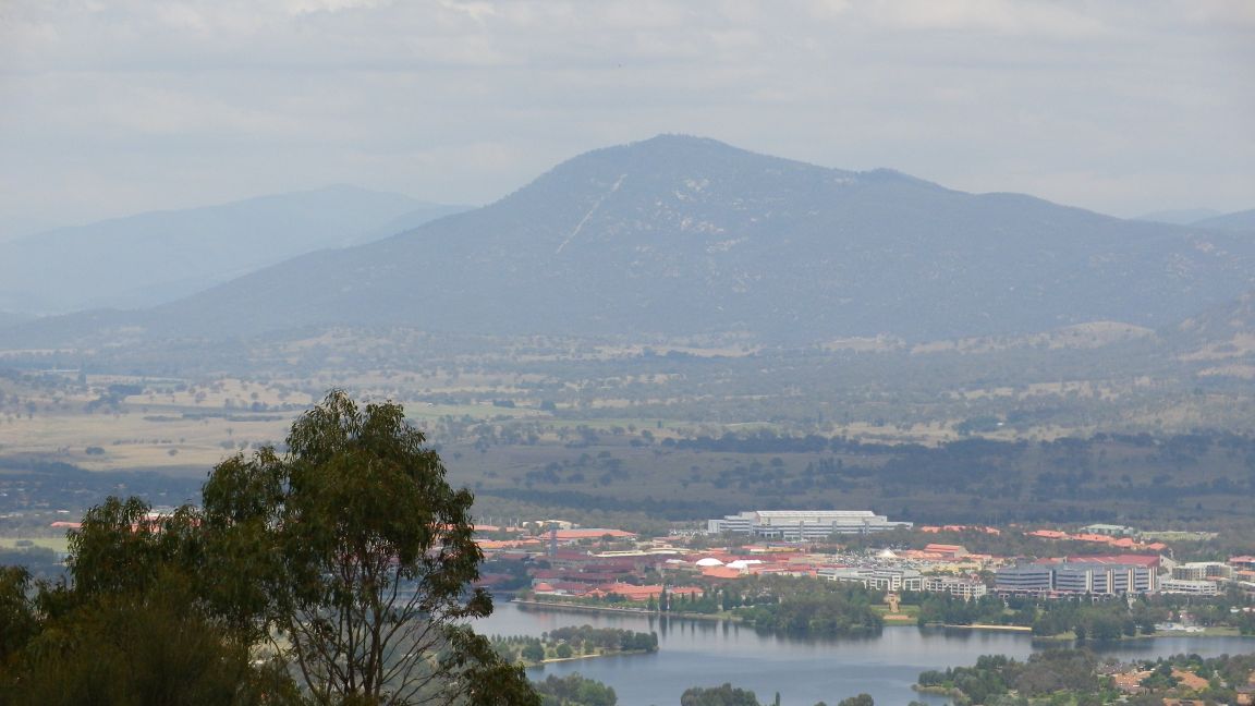
Picture taken two days earlier without the mist was a lot clearer.

You must be logged in to post a comment.