
With benign early winter weather, cool mornings but calm clear days, it was clearly the right weather for activating summits.
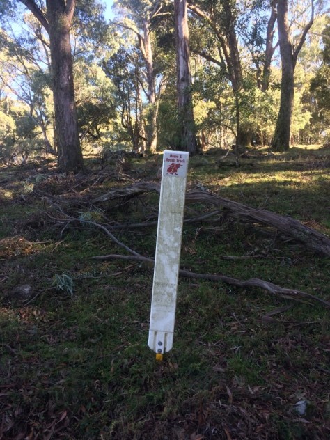
The first was Mt Wee Jasper. It is on a famous walking track known as the Hume and Hovell walking trail. It can be accessed from the camping area south of the Wee Jasper village, but the walk is long and recent forestry work has apparently disrupted the trail. At 7+ km it would have taken too much time out of the day too. So my access route was to first head west on the Wee Jasper-Tumut road, then southwards on the Wee Jasper forest road by a few km. Turning off onto Pheasant Creek Rd, the mountain looms into view soon and the route to the parking area is fairly obvious though the road has been cleared of any gravel and may well be soft after heavy rain.
It is a pleasant and easy walk of about 15 minutes up the forest path to the summit, where there are two concrete-and-wood benches ideal as sitting and operating radios.
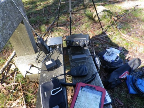
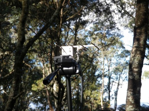
I deployed the zs6bkw doublet for hf with the kx3. For 1296 the ft 817 and the transverter were connected to the 4 el yagi mounted on the camera tripod. The icom v85 was used to make some contacts into Canberra on 2m fm. No available contacts for 1296 but the Canberra beacon from Mt Ginini was very strong. On hf it was easy enough to make contacts on 40 and 80m bands using ssb and cw. I aim to “qualify” each summit on both ssb and cw. It is also satisfying to make the required 4 contacts to “qualify” on each band, though this is a personal goal rather than any external requirement.

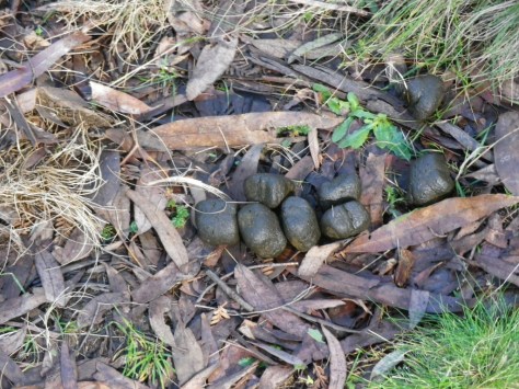
You may have read that wombats leave a rather uniquely shaped message on the ground. Here are a few I stepped over on my way up Mt Wee Jasper. Each “cube” is about a cubic inch. How they shape them like that is a matter others can deal with.
Despite the pleasant forest environment it was time to depart after an hour on summit, then pack away and head for the car. I had looked at the navigation options for reaching the next summit and concluded that the known roads were a more reliable option than trying to find shortcuts. So southwards on Wee Jasper forest road to Brindabella rd, east for a few km, then turning northeast along Nottingham Rd. About 15 km along this road is the parking point for Snowgum Mt. There is no public car access up to the summit so requires a steepish walk up a sealed road littered with leaves and twigs from the eucalyptus trees.


Setting up the gear again I heard signs that Andrew vk1ad was ready at Mt Stromlo for the planned s2s contacts including 1296 ssb. Hearing his voice weakly at first, I experimented with the position and direction of my antenna, peaking the signal in the expected direction. When his contact with a Canberra station ended, I called him and received a question as to who was calling. I moved to cw mode and sent a 20-30 second string of dots using that mode, to allow him to find the best antenna direction by setting it for the maximum signal. Dots are very good for this purpose as they have a constant average signal strength but are transmitted at maximum power, much stronger than voice signals with an average power of less than 30% of maximum. His reply came much stronger than the level I had previously heard. In fact over the next 5 minutes, signal strengths gradually increased to about 8 on the ft817 “blobometer”. (It isn’t a real meter, just blobs being lit up on the lcd display. )
Several additional contacts were then made on 2m fm, starting with Wade vk1mic, Matt VK1MA, then Dean VK1DW and I could hear Dermy VK1FDHA calling me but he was not hearing me on any of the antennas he tried. I also heard Peter vk1fphr calling but he also didn’t hear my replies.
At this point it was approaching 2pm and I knew that if I didn’t leave soon for my next summit, my departure from that summit would be in darkness. So I didn’t set up the hf antenna on this summit, failing to meet my goal of “qualifying” on several hf bands and also on cw. A return visit this year may be necessary.
I reached the next summit just on one hour after my planned activation time, sunset was at about 5 pm so I needed to get the contacts in the log. A few contacts were made with Wade and Matt over in Canberra on 2m fm but the rest of the activity was on 80m ssb and cw. I went to 40m but made only a couple of contacts on that band. Propagation conditions near sunset make distances below about 800 km quite difficult on that band. I was using my phone to log the contacts, as i could not find my logging tablet when I unpacked my gear on this summit. Had I left it in the car? Or had I packed up so quickly at Snowgum Mt that I had left the tablet there? It turned out that I hadn’t left it in the car at all, more of that to come.


I would have to go to my backup logging technology, paper and pen. That posed a small problem because although I had a notebook there was no pen in my pack or in the accessories box. Then I remembered that I had been intending to test the logging functions in the ParksnPeaks ios app on my iPhone. So, logging on this site was done using the ParksnPeaks app on the iPhone and it did it very well. The test version I had was working well.
It was then coincidental and somewhat ironic that when I went to 40m I was called by Sue vk5ayl, the developer of the ParksnPeaks app. We had a good chat and I mentioned that i was using the app for logging.
But the light was fading and I had to get out of the forest before darkness made it difficult. So I called it quits at about 5pm, packed up and found my way back to the car.
Approaching the car, I was surprised but relieved to find my logging tablet on the ground behind it. Thinking back to when I had prepared for the activation, removing the ft817, 1296 transverter and tripod from the pack, I must have dislodged the tablet and failed to put it back into the pack. Another reminder of how important it is to look around before departing.
It was now almost dark and I did not want to drive back through the Wee Jasper forest, it is the time of day when kangaroos and wallabies move around in search of food. So I drove west to Tumut, stopped at the Oriental Hotel for dinner, then drove to Gundagai and back to Yass along the Hume highway. The highway is also named after the early explorer whose name was given to the walking track mentioned earlier.
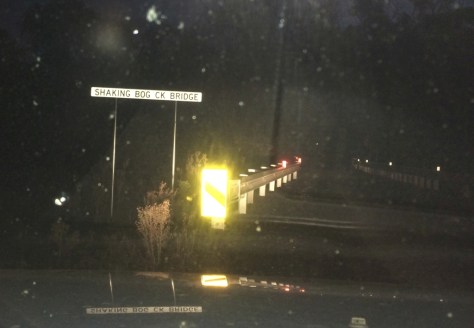
On the way I crossed this bridge with a unique name, I couldn’t resist stopping to take a photo of the bridge sign. The bogs must shake a lot in that area.
Three summits, 18 activator points and some s2s points for the summit-to-summit contacts made. And a good meal at the Oriental.

You must be logged in to post a comment.